 vesseltracker.com
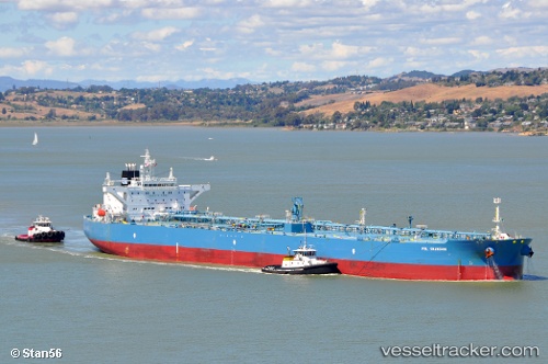
Vessel MA JIN IMO: 9346744, MMSI: 352003394 Crude Oil Tanker
UTC, 26.57522, 51.82371, course: 41, speed: 0.4
UTC, 13.30868, 51.88665, course: 16, speed: 0
UTC, 13.30868, 51.88665, course: 16, speed: 0
UTC, 13.30868, 51.88665, course: 16, speed: 0
2026-02-21 03:49:32 UTC, 13.30868, 51.88665, course: 16, speed: 0
Live AIS position:
UTC. 27 nm SW of Gross Koris),
updated 2026-02-21 03:49:32 UTC.
Find the position of the vessel MA JIN on the map. The latter are known coordinates and path.
marine traffic ship tracker show on live map
The current position of vessel MA JIN is 13.30868 lat / 51.88665 lng. Updated: 2026-02-21 03:49:32 UTCCurrently sailing under the flag of Panama
MA JIN built in 2007 year
Deadweight:
115915 tDetails:
Last coordinates of the vessel:
UTC, 26.57522, 51.82371, course: 41, speed: 0.4UTC, 26.57522, 51.82371, course: 41, speed: 0.4
UTC, 13.30868, 51.88665, course: 16, speed: 0
UTC, 13.30868, 51.88665, course: 16, speed: 0
UTC, 13.30868, 51.88665, course: 16, speed: 0
2026-02-21 03:49:32 UTC, 13.30868, 51.88665, course: 16, speed: 0